Showing posts with label university of leeds. Show all posts
Saturday, 4 July 2020
'Presupposed actualization and the discourse of architectural development plans' by Fenella Brandenberg
Let Me Tell You a Story: Presupposed actualization and the discourse of architectural development plans.
By Fenella Brandenburg.
Please click here for free downloadable copy of this essay.
Abstract of essay:
This essay discusses how architectural development plans form a narrative that tells a story of the future space being proposed. This story, embedded in a discourse that is circulated by those in authority in regard to the project’s manifestation, has two main effects. Firstly, it changes the subjectivity of those involved in the decision-making process and, secondly, the ideological structure surrounding the development makes the anticipated project, in the minds of those involved, exist in advance. These effects are known as presupposed actualization. By providing an example of a development project carried out in the UK in the 1960s - and by using theories around narratology, ideology, discourse and representation – the author demonstrates how this comes about through the telling of a story and because of the material actions undertaken by those invested in the project.
Friday, 8 June 2018
'Gudbuy T'Leeds': A Teeny Tiny Psychogeographical Goodbye to the University of Leeds
This is a very short film of my last wander on campus, saying goodbye to some of the places there. The title of the blog is a nod to Slade's 1972 single 'Gudbuy T'Jane', for those of you who can remember it. My trip was aided by Rob from Engineering, who you will briefly see in the film.
I'm off to the Manchester Fashion Institute at MMU now!
Click here for the film: Gudbuy T'Leeds
I'm off to the Manchester Fashion Institute at MMU now!
Click here for the film: Gudbuy T'Leeds
Saturday, 13 January 2018
Hiding the Bodies: Geographic Repression in Higher Educational Space
Abstract
This article critiques the way that universities have acquired and developed campus space since World War II. Prompted by the need to increase student entry, British universities grew exponentially, with a demand to expand the campus in order to provide more teaching space and student accommodation. This article looks at the side effects of this expansion by providing a case study that demonstrates that land acquisition can have a deleterious effect on local residents. Using theories from urban studies, postmodern geography and cultural theory, this article presents the case study through a transdisciplinary lens, offering an original analysis of the heritage of an inherited cemetery.
Keywords: campus planning, social history, capitalism, urban regeneration, burial land
You can read and download the article for free here: Space and Culture Journal
Thursday, 29 October 2015
Reading the Campus, Reading the City - Learning Resource
This blog is for lectures in the School of Fine Art, History of Art and Cultural Studies at the University of Leeds w/b 01/11/2015.
This blog includes:
- An overview of what to expect on the lecture/walk
- Information on the architectural moments at the University of Leeds
- A pre-lecture quiz
- Links to other resources
- A link to the slideshow from the lecture
- Answer to the prize question (see below)
ANSWER TO QUESTION ON WALK
The prize for the question on the walk has now been won. The answer is that the image below is a Fire Point and states how far the wall is to the water hydrant in the street:
OVERVIEW OF LECTURE AND WALK
ARCHITECTURAL MOMENTS
You might find the following summary of architectural styles at the University of Leeds interesting. Please note, the time-frames shown in the images below the text are very rough, because: cultural epochs bleed into each other, they are different depending on what field of theory you are discussing, there are (often) many socio-political impacts on design styles (e.g. war) and all 'moments' need to be individually contextualised in their given setting:
This extract is from 'The Unseen University: A Schizocartography of the Redbrick University Campus' by Tina Richardson (2014):
"At the point the Yorkshire College became part of the Victoria University it was comprised of the Clothworkers’ Buildings, the Baines Wing, an engineering building and some administrative offices, which were set apart from each other (Shimmin 1954: 18). In 1894 the Great Hall and the Library were completed in the space between these sets of buildings, but Shimmin states that “No attention seems to have been given to planning; block after block rose in response to the pressure of successive needs and the architecture naturally lacked coherence” (ibid.). The university inherited these red brick buildings, although some of the college’s original buildings were located in the city centre, and no longer belong to the university. The university still continued to use the terracotta bricks on occasion, as can be seen in the Beaux-Arts style Brotherton Library, completed in 1936.
The campus site was redeveloped in the 1920s with Art Deco influenced buildings, often containing neo-classical elements like the Parkinson Building, and mostly made in Portland Stone (an interesting looking Jurassic stone which reveals fossils in its surface), although not exclusively. Portland Stone was often used in royal, religious and public buildings from the 11th the 20th century. As a material it makes a statement about public life and civic pride. Not only can this often be seen in buildings such as Buckingham Palace, but also in British Town Halls. While some of the previously planned buildings were not actually finished until after World War Two, it is clear from their style they emanate from the 1920s and 1930s, rather than their period of completion, sometimes the 1950s, as is the case with the Parkinson Building, the entrance to the Brotherton Library.
By the time the Brotherton Library was finished in 1936, the demand for book space had increased again and the new space was already fully utilised. Shimmin dedicates a whole chapter to the library: “An adequate library is not only the basis of all teaching and study; it is the essential condition of research, without which additions cannot be made to the sum of human knowledge” (1954: 117). The first library building for the university was opened in 1895. Today there exists alongside the Brotherton Library (a red brick building but with an entrance built later in Portland Stone), the Edward Boyle Library (from the 1960s concrete-based architectural period), the Health Sciences Library (located at the Worsley Building, 1960s built), the St James University Hospital Library (a very recent building near the hospital), the university archive which is located in the Baines Wing (red brick period) and the new library (under construction as of August 2013). It is clear from just introducing this one university function as an example (book provision), how university processes are actualised spatially – in this case architecturally – and how the aesthetics attached to these buildings is complex because of the differing architectural periods which have different ideologies attached to them.
Beresford states that it is the long-standing relationship that the university had with the city council that enabled the clearing of areas of terraces for both the campus buildings built in Portland Stone and the later concrete Brutalist buildings in the early 1960s, a significant period of development. The period of Portland Stone was associated with the Vice-Chancellor James Baillie in the time leading up to Work War Two. Portland Stone campus buildings include the Old Mining Building (opened in 1930) and the Chemistry Building (opened in 1934), located next to each other on the Woodhouse Lane side of the campus. Up until the 1960s, the campus development by CPB was the fourth of four main periods of development for the University of Leeds. Each period had different architects (both in-house and hired ones), with distinctly diverse architectural styles, both in design and often in the material used."
Here are the images that refer to the above text:
QUIZ - PRE-LECTURE
If you would like to test your campus knowledge pre-lecture, take a look at these campus phenomena:
What is this and where is it located?
Who is this sculpture by and where can you see it?
What road is this walking figure on? How long has it been there?
LEEDS LINKS
For more information on the University of Leeds campus and St George's Field you can click on my thesis here: The Unseen University.
You can also get access to Robert Frederick Fletcher's thesis in the library for further information on the cemetery:
Fletcher, Robert Frederick, ‘The History of the Leeds General Cemetery Company 1833-1965’ (unpublished doctoral thesis, University of Leeds, 1975).
OTHER RESOURCES
Walking Inside Out: A textbook on contemporary British psychogeography.
A map showing the blue plaques on campus.
Blogs by other psychogeographers: Alex Bridger, John Rogers and Gareth Rees.
A free downloadable psychogeography zine: STEPZ.
Tom Vague: Psychogeography Reports.
Mapping the Campus by Paul Mullins.
A TED-Ed lesson on psychogeography: What is psychogeography?
Thursday, 2 July 2015
The New Laidlaw Library at the University of Leeds - Part 1
On Knowledge and Phalluses
The new Laidlaw Library is almost in full working order following its recent completion. The students are in place, even though the books have yet to be moved across during the summer break. I attended the launch of its associated sculpture on June 11: A Spire by Simon Fujirawa (see below).
I do appreciate the context of this ‘chimney’ sculpture, oriented in an industrial city as it is, not least since the university was originally funded by industry in its early days as the Yorkshire College. However, on one level it is just another phallus (and I was not the only person commenting on this at the launch). If this is the case, what does this say about knowledge and the phallus, I wonder. If A Spire is a nod to Leeds’ past, then we can intrinsically tie this to education since the colleges that preceded the University of Leeds – The Yorkshire College and Medical School – provided education to the sons (only) of the local bourgeoisie:
The subject (in this instance the university) believes the phallus belongs to him. He believes his mastery over language (knowledge) means he owns the phallus, but he doesn't have the phallus, he only has the penis-sculpture. The university as the speaking subject (that of one oriented in the institutional power structure and hence in ‘control’ of the discourse), is actually, therefore, oriented in a “structural hole” (Nancy and Lacoue-Labarthe 1992, p.46).
I originally had a section on the Laidlaw Library in an early draft of my thesis (2014). Unfortunately I had to cut it out due to space issues. You can read the full thesis here – The Unseen University: A Schizocartography of a Redbrick – but I’ll include the original section I wrote about the new library, during its development, in part 2 of this blog.
Bibliography:
Althusser, Louis. 2006. Lenin and Philosophy and Other Essays, trans. by Ben Brewster (Deli: Aakar Books).
Nancy, Jean-Luc and Lacoue-Labarthe, Philippe. 1992. The Title of the Letter: A Reading of Lacan, trans. by Francois Raffoul and David Pettigrew (Albany: State University of New York Press).
Richardson, Tina. 2014. ‘The Unseen University: A Schizocartography of a Redbrick’. University of Leeds.
Related Links:
Contemplating Olympic Space, the Shard and Architectural Phalluses in General
The new Laidlaw Library is almost in full working order following its recent completion. The students are in place, even though the books have yet to be moved across during the summer break. I attended the launch of its associated sculpture on June 11: A Spire by Simon Fujirawa (see below).
I do appreciate the context of this ‘chimney’ sculpture, oriented in an industrial city as it is, not least since the university was originally funded by industry in its early days as the Yorkshire College. However, on one level it is just another phallus (and I was not the only person commenting on this at the launch). If this is the case, what does this say about knowledge and the phallus, I wonder. If A Spire is a nod to Leeds’ past, then we can intrinsically tie this to education since the colleges that preceded the University of Leeds – The Yorkshire College and Medical School – provided education to the sons (only) of the local bourgeoisie:
It is important to note that while the forming of the Yorkshire College was a reaction against an exclusive further education for just the upper classes, the college was providing education for the middle-classes only, in the form of an education for the sons of local merchants in the fields of science and the arts. (Richardson 2014)In cultural theory the phallus is “the order of spacing, according to which the law is inscribed and marked as difference.” (Nancy and Lacoue-Labarthe 1992, p.46). And difference (sexual difference) pushes the terms of difference outwards, fixing them in opposing domains: men - women. Woven around this ‘story’ that fixes the individual (it subjects them) in language (and hence in culture) is an intricate illusion for this linguistic subject. An illusion that gives the impression of orientation, autonomy and access to truth, what Louis Althusser would describes as the “structure of misrecognition”, the ego’s inability to see itself outside of any ideological structures (2006, p.149).
The subject (in this instance the university) believes the phallus belongs to him. He believes his mastery over language (knowledge) means he owns the phallus, but he doesn't have the phallus, he only has the penis-sculpture. The university as the speaking subject (that of one oriented in the institutional power structure and hence in ‘control’ of the discourse), is actually, therefore, oriented in a “structural hole” (Nancy and Lacoue-Labarthe 1992, p.46).
I originally had a section on the Laidlaw Library in an early draft of my thesis (2014). Unfortunately I had to cut it out due to space issues. You can read the full thesis here – The Unseen University: A Schizocartography of a Redbrick – but I’ll include the original section I wrote about the new library, during its development, in part 2 of this blog.
Bibliography:
Althusser, Louis. 2006. Lenin and Philosophy and Other Essays, trans. by Ben Brewster (Deli: Aakar Books).
Nancy, Jean-Luc and Lacoue-Labarthe, Philippe. 1992. The Title of the Letter: A Reading of Lacan, trans. by Francois Raffoul and David Pettigrew (Albany: State University of New York Press).
Richardson, Tina. 2014. ‘The Unseen University: A Schizocartography of a Redbrick’. University of Leeds.
Related Links:
Contemplating Olympic Space, the Shard and Architectural Phalluses in General
Saturday, 13 June 2015
In Memory of Pauline Mavis White (1946)
Meeting Across Time and Space in St George’s Field
In May I was kindly invited by Christine Bairstow to a memorial event in the cemetery at the University of Leeds, St George’s Field. Every year Christine visits the cemetery on the campus where her sister, Pauline Mavis White, is buried. Pauline is Christine’s twin sister and died on the 10th of June 1946, when they were 6 months old, after a serious illness that they both suffered. This blog is to say thank you to Christine for generously asking me to share her very special afternoon. The images and text will be interspersed with relevant text from my doctoral thesis, which is actually how Christine found me to start with.
My thesis examined the way the university has historically used space and the contradictions between the higher level discourse of the institution and how it is spatially played out in regards to social history. There is a full chapter on the cemetery entitled ‘Finding St George’s Field’ and a section within that on Christine and Pauline called ‘In Memory of a Dear Sister’. You can read the full thesis here: ‘The Unseen University: A Schizocartography of the Redbrick Campus’
In summary, the University of Leeds acquired the cemetery during the major (Chamberlin, Powell and Bon) 1960s redevelopment period on campus. At this time Woodhouse Cemetery was in a state of disrepair. Initially the university had hoped to be able to maintain the cemetery as it was, but on further examination this turned out to be too expensive and they got an Act of Parliament in 1965 to enable them to purchase the shares for the plots and then turn the cemetery into a landscaped park. This led to the setting up of the Woodhouse Cemetery Defence Organisation to protect the cemetery, but the university won the battle in the end. The gravestones were removed, although the bodies still remain.
Wednesday 10th June 2015 was a beautiful sunny day and I caught site of Christine in the distance walking towards the space under a tree where the plaque is located. I recognised her from her facebook profile image. She was carrying flowers.
“It might not initially be apparent that the eventual procurement of the cemetery land by the university is one oriented towards a capitalist agenda, but as Guattari states, “capitalistic modes of production” do not necessarily manifest in obviously capitalist-oriented procedures (2008a: 21). I argue that while the cemetery acquisition, on a superficial examination, appears to have little to do with capital, it is a function of the agenda of the new university, the neoliberalist, posthistoric model. The social history of the cemetery is problematic for the university. Nevertheless, the capitalist agenda is one that is capable of eventually dealing with these conjunctions because it can both organise time and space in a way where incongruities become unproblematic: “The power sign’s polyvocality enables it to tolerate these structural alliances perfectly well” (Guattari 2006: 228). Polyvocality is capitalism’s recuperation of heterogeneity. It reformulates and repackages it and presents it back to us in an attractive, seemingly innocuous, form, to be further consumed. Thus, the cemetery is now consumed as a public garden.”
Christine told me about her sister and parents and about her own childhood. She explained that the university had a planted a tree for the family a little way away from the actual unmarked plot. She showed me the approximate place where Pauline is buried and she sat there and I took the photo above.
“In one sense St George’s Field, as a postmodern space located within an institutional setting, has become a reconciled space when situated within the larger project of capitalism. Its renaming, back to its original name, creates a form of distance from its ‘real’ function (it still is a graveyard after all) and its controversial recent history. St George’s Field, hence, becomes a new space making it easier to forget a past that is not attached to it via the proper noun (Woodhouse Cemetery or Leeds General Cemetery). St George’s Field is at odds with itself, in being both a cemetery and at the same time a public park of sorts. Can it simultaneously reconcile itself as a place of leisure and a sacred burial space? What is apparent is that changing its name has changed its function and this has enabled both a type of cultural forgetting to take place and also the availability of a whole new set of powers to both the Council and university in how they control, market and manage the space.”
Thank you, Christine, for inviting me along to your memorial day, I was extremely touched to be part of it and it was really lovely to meet you.
Related Links on St George’s Field:
Dying to Find It
A Not So Hotsy Totsy Sunny Day
The Psychogeography of Other Spaces
Fallow Again
In May I was kindly invited by Christine Bairstow to a memorial event in the cemetery at the University of Leeds, St George’s Field. Every year Christine visits the cemetery on the campus where her sister, Pauline Mavis White, is buried. Pauline is Christine’s twin sister and died on the 10th of June 1946, when they were 6 months old, after a serious illness that they both suffered. This blog is to say thank you to Christine for generously asking me to share her very special afternoon. The images and text will be interspersed with relevant text from my doctoral thesis, which is actually how Christine found me to start with.
My thesis examined the way the university has historically used space and the contradictions between the higher level discourse of the institution and how it is spatially played out in regards to social history. There is a full chapter on the cemetery entitled ‘Finding St George’s Field’ and a section within that on Christine and Pauline called ‘In Memory of a Dear Sister’. You can read the full thesis here: ‘The Unseen University: A Schizocartography of the Redbrick Campus’
In summary, the University of Leeds acquired the cemetery during the major (Chamberlin, Powell and Bon) 1960s redevelopment period on campus. At this time Woodhouse Cemetery was in a state of disrepair. Initially the university had hoped to be able to maintain the cemetery as it was, but on further examination this turned out to be too expensive and they got an Act of Parliament in 1965 to enable them to purchase the shares for the plots and then turn the cemetery into a landscaped park. This led to the setting up of the Woodhouse Cemetery Defence Organisation to protect the cemetery, but the university won the battle in the end. The gravestones were removed, although the bodies still remain.
Wednesday 10th June 2015 was a beautiful sunny day and I caught site of Christine in the distance walking towards the space under a tree where the plaque is located. I recognised her from her facebook profile image. She was carrying flowers.
“It might not initially be apparent that the eventual procurement of the cemetery land by the university is one oriented towards a capitalist agenda, but as Guattari states, “capitalistic modes of production” do not necessarily manifest in obviously capitalist-oriented procedures (2008a: 21). I argue that while the cemetery acquisition, on a superficial examination, appears to have little to do with capital, it is a function of the agenda of the new university, the neoliberalist, posthistoric model. The social history of the cemetery is problematic for the university. Nevertheless, the capitalist agenda is one that is capable of eventually dealing with these conjunctions because it can both organise time and space in a way where incongruities become unproblematic: “The power sign’s polyvocality enables it to tolerate these structural alliances perfectly well” (Guattari 2006: 228). Polyvocality is capitalism’s recuperation of heterogeneity. It reformulates and repackages it and presents it back to us in an attractive, seemingly innocuous, form, to be further consumed. Thus, the cemetery is now consumed as a public garden.”
Christine told me about her sister and parents and about her own childhood. She explained that the university had a planted a tree for the family a little way away from the actual unmarked plot. She showed me the approximate place where Pauline is buried and she sat there and I took the photo above.
“In one sense St George’s Field, as a postmodern space located within an institutional setting, has become a reconciled space when situated within the larger project of capitalism. Its renaming, back to its original name, creates a form of distance from its ‘real’ function (it still is a graveyard after all) and its controversial recent history. St George’s Field, hence, becomes a new space making it easier to forget a past that is not attached to it via the proper noun (Woodhouse Cemetery or Leeds General Cemetery). St George’s Field is at odds with itself, in being both a cemetery and at the same time a public park of sorts. Can it simultaneously reconcile itself as a place of leisure and a sacred burial space? What is apparent is that changing its name has changed its function and this has enabled both a type of cultural forgetting to take place and also the availability of a whole new set of powers to both the Council and university in how they control, market and manage the space.”
Thank you, Christine, for inviting me along to your memorial day, I was extremely touched to be part of it and it was really lovely to meet you.
Related Links on St George’s Field:
Dying to Find It
A Not So Hotsy Totsy Sunny Day
The Psychogeography of Other Spaces
Fallow Again
Tuesday, 3 February 2015
The Semiotics of Space and the Culture of Design
Talk at the University of Leeds, School of Design 4th February 2015
Abstract:
This talk looks at how design influences the development of, and our perceptions of, space. By taking two examples, an architectural plan and a wayfinding device, Tina demonstrates how design can project a future space through the imagination of the designers, one that becomes concretised through a particular discourse. She also provides the example of a map in order to unpick how design elements and motifs can be read as signs that speak about specific ideological agendas that might not be obvious on a cursory viewing. The examples she will be discussing represent a place that will be very familiar to you, the campus at the University of Leeds.
Bio:
Tina Richardson is an independent scholar in the field of Urban Cultural Studies. She specialises in psychogeography, the aesthetics of urban space and the postmodern city. Completing her PhD at the University of Leeds in 2014, she is now guest lecturing while finishing her book - Walking Inside Out – which will be published in July 2015.
Tuesday, 1 July 2014
Vernacular Mapping
Joe Gerlach’s article on vernacular mapping, ‘Lines, Contours and Legends: Coordinates for Vernacular Mapping’, looks at micropolitical actions in relation to cartography. He states: “Vernacular mapping inheres in the material co-production of cartographies by humans and non-humans alike whereby the underlying ethos remains intensely political, but in a tenor distinct from the representational politics allied traditionally to maps” (2013: 2). He summarises it as “the co-production of knowledges, materials and spaces” (2013: 10). Offering vernacular mapping as a model that integrates other mapping practices such as counter maps and indigenous mapping practices, Gerlach sees them as assemblages of enunciation and valid expressions of affective responses to space (2013: 11-13).
The assemblages of community that can be formed out of joined-up lines of flight, enable a cartography to appear that can become vernacular in its response: “these cartographic lines perform. Likewise, in their unfolding effects and affects, lines are performative” (Gerlach 2013: 5). The lines of flight are performative inasmuch as they are both transversal – taking untraditional routes – and execute actions. The schizocartography reflected in the map above highlights what Gerlach would describe as “cartographic articulations” and it is this that makes it performative (2013: 13). The map represents the culmination of a number of dérives carried out on the University of Leeds campus during the summer of 2009 which were carried out in conjunction with members from Leeds Psychogeography Group. Cartographic articulations operate against the grain, counter to the well-trodden urban path, while at the same time recognising the dominant structure for what it is, what it does and what it represents.
Please click here for an online article on Vernacular Mapping on Campus
Bibliography:
Gerlach, Joe. ‘Lines, Contours and Legends: Coordinates for Vernacular Mapping’, Progress in Human Geography, July (2013), 1-18.
Wednesday, 25 June 2014
Cognitive Mapping
While Fredric Jameson dedicates Postmodernism: The Cultural Logic of Late Capitalism to the cognitive map problem, he does not provide a definitive answer on how to proceed. However, he does offer his analysis on the concept of cognitive mapping as it appears within postmodern theory:
These are, then, not really theories, but rather themselves unconscious structures and so many afterimages and secondary effects of some properly postmodern cognitive mapping, whose indispensable media term now passes itself off as this or that philosophical reflection on language, communication, and the media, rather than the manipulation of its figure (2009: 417).He highlights the problem at its most fundamental level: if the system itself does not change, then all we are able to do is contemplate it within its system of effects (and with the tools) it produces. This is not a new problem for theory – the inside/outside dichotomy of language – but, it does leave us with the perennial problem of where to go. The concepts highlighted above – such as the need for tools to navigate the environment, and the materiality of space and its system of effects – lend themselves to discussion within the field of psychogeography and under the umbrella of cognitive maps, also.
Roger M. Downs and David Stea’s Maps in Minds: Reflections on Cognitive Mapping (1977) is an extensive geo-psychological study of cognitive mapping, although it does not deal with mental and physical space in any political sense. It offers a concise study of psychogeographical cognitive effects and provides definitions of cognitive mapping: “Cognitive mapping is an abstraction covering those cognitive or mental abilities that enable us to collect, organize, store, recall and manipulate information about the spatial environment” (1977: 6). They explain that cognitive maps are not just visual images contained in our minds but are also connected to our other senses (1977: 23). While they acknowledge ‘the social’ as one part of what influences our cognitive maps, they do not deal with the complexities of postmodernity as it pertains to culture and/or capitalism. However, since their text was published in 1977, it may have been too early to take a retroactive position on postmodern space.
In his essay ‘Cognitive Mapping the Dispersed City’, Stephen Cairns cites Kevin Lynch’s The Image of the City as his own influence. While Lynch provides an analysis by form – looking at various urban elements such as paths, landmarks and edges – he adopts a post-war narrative, the book being written in 1960. Cairns’s critique is in the way that Lynch’s cognitive mapping may be further used to decentre the subject in the form of how they appear as “‘the user’, ‘the community’ and ‘the people’” (2006: 193). This could be seen as both positive and negative, depending on differing perspectives attached to ‘where you stand’. Decentring is considered a common position for the individual to take up in the postmodern text (such as in deconstruction). When that text is the city landscape, this may enable an opening up of other views of the city, such as its edgelands. It encourages differing perspectives with regard to a sense of place. However, the concept of decentring may be considered as a devaluing of the citizen in the centre of public life (as it pertains to the city as civic centre).
Cairns is concerned with what is not representable in and of the city. Citing Harvey, Jameson, Baudrillard and Debord, he discusses the material reality of the city with its postmodern problems of wayfinding, while seeking out its ‘blind spots’ in an attempt to answer some questions about cognitive mapping. These “blind spots” appear on “a refined spectrum between social space and architectural space such that conventional representational logics simply cannot register them” (2006: 203).
Please click here for a free online article on Cognitively Mapping the Campus
Related Links:
GPS Trails on Campus
Blue Plaques on Campus
Bibliography:
Cairns, Stephen. 2006. ‘Cognitive Mapping the Dispersed City’, in Christoph Lindner (ed.), Urban Space and Cityscapes: Perspectives From Modern and Contemporary Culture (London and New York: Routledge), pp. 192-205.
Downs, Roger M. and David Stea. 1977. Maps in Minds: Reflections on Cognitive Mapping (London and New York: Harper and Row).
Jameson, Fredriç. 2009. Postmodernism or The Cultural Logic of Late Capitalism (London and New York: Verso).
Thursday, 19 June 2014
Open Source Mapping: GPS Trails on Campus
The following map shows the GPS trails of people who have walked around the University of Leeds campus area and have then loaded their data onto OpenStreetMap. OpenStreetMap is open source software by the OpenStreetMap Foundation and is a collaboration by its contributors providing free geographical data and mapping. Anyone can contribute by signing-up online. The data shown in the map below shows the walks made by people walking around campus while at the same time logging their route using GPS software on their smartphone. They have subsequently loaded this information onto OpenStreetMap. Some of the data on this map goes back to the campus dérives I did with Leeds Psychogeography Group in 2009 and our walks actually appear within the consolidation of trails you can see on this map.
These lines are made up of tiny dots which are overlaid in places. The dots make up a trail by an individual, which can be seen when zooming into the map online. Each dot represents the moment when the GPS picked up a signal of that individual’s location. The darker the line, the more people have carried out this process while walking that particular route. Speed is indicated by a greater gap between dots. Pauses appear as a density of dots. The GPS device might indicate a route taken on a cycle or, also, in a car.
What is interesting about the above map is that no map outline is included in the image, nevertheless the outline of the campus appears in the accumulation of dots, as you can see by looking at this map which is taken from the Chamberlin, Powel and Bon Development Plan.
This map (and the previous one on Blue Plaques) show the infinite possibility for cartographies to become ways of presenting personal and qualitative information while also handing over a degree of control of the mapping process and end result to the user/cartographer. The open source software that is often used for these types of collaborations also, to a large extent, disengages it from capitalist production and, hence, provides much more freedom of expression, production and distribution.
Related Links:
Open Source Mapping: Blue Plaques on Campus
© OpenSteetMap Contributors and CC Tim Waters
These lines are made up of tiny dots which are overlaid in places. The dots make up a trail by an individual, which can be seen when zooming into the map online. Each dot represents the moment when the GPS picked up a signal of that individual’s location. The darker the line, the more people have carried out this process while walking that particular route. Speed is indicated by a greater gap between dots. Pauses appear as a density of dots. The GPS device might indicate a route taken on a cycle or, also, in a car.
What is interesting about the above map is that no map outline is included in the image, nevertheless the outline of the campus appears in the accumulation of dots, as you can see by looking at this map which is taken from the Chamberlin, Powel and Bon Development Plan.
© University of Leeds and Chamberlin, Powell and Bon
This map (and the previous one on Blue Plaques) show the infinite possibility for cartographies to become ways of presenting personal and qualitative information while also handing over a degree of control of the mapping process and end result to the user/cartographer. The open source software that is often used for these types of collaborations also, to a large extent, disengages it from capitalist production and, hence, provides much more freedom of expression, production and distribution.
Related Links:
Open Source Mapping: Blue Plaques on Campus
Saturday, 14 June 2014
Open Source Mapping: Blue Plaques on Campus
Blue Plaques are signs that are placed on places of historical interest and are administered by English Heritage. This map shows those Blue Plaques on the University of Leeds campus and in the surrounding area: for example, there is one dedicated to Clifford Allbutt who was a physician at the Medical School in Leeds and invented the first compact medical thermometer. There is also one on the Students’ Union for the band The Who, who played in the Refectory in February 1970. The gig spawned their famous album Live at Leeds.
CC Open Plaques and Tim Waters
These types of maps can be made for one’s own use by utilising open source software, such as, in this case, Open Plaques. Data can be filtered and the map scaled to fit one’s criteria. Many of the images that can be produced from open source software are often Collective Commons (CC) attributed, which provides much more freedom than a regular copyright.
Related Links:
Open Source Mapping: GPS Trails on Campus
Related Links:
Open Source Mapping: GPS Trails on Campus
Saturday, 23 November 2013
Power, Planning and Pathways
Figure 1 – This map/plan shows the colour-coded routes proposed for the new campus.
In Discipline and Punish Michel Foucault makes it clear that the power/knowledge process does not fix docile bodies in space, but actually puts them in circulation in relation to power. Rather than demonstrate this through the more obvious discussion of surveillance, which appears as one of the primary modes of power in postmodern urban space, I should like to look at how the planning of the University of Leeds campus provides a much more subtle and less obvious way of controlling bodies, than does surveillance through CCTV.
Foucault explains that the modern factories of the 18th century were organised in terms of “disciplinary space”. (1991: 143) The space of the factory was designed so that individuals were kept in their own physical space and movement was controlled in order to prevent groups of people collecting together: “Its aim was to establish presences and absences, to know where and how to locate individuals, to set up useful communications, to interrupt others, to be able at each moment to supervise the conduct of each individual”. (Ibid.) In his discussion on a new approach to education in the classical period, Foucault describes how the model that is applied to the factory is also applied to the school. Space is organised in such a way to make processes as efficient as possible: “The disciplines, which analyse space, break up and rearrange activities, must also be understood as machinery for adding up and capitalizing time.” (1991: 157)
Figure 2 – This sketch is a vision of the new university.
This efficiency, in terms of organising space, is apparent when viewing the development plans of Chamberlin, Powell and Bon for the University of Leeds in the early 1960s. One of the maps in the plan shows the proposed pathways for pedestrians on the campus (figure 1). These new routes also included covered walkways that helped students move from one teaching building to another, while protecting them from the elements (figure 2). While it seems that the intention of the architects was to encourage students to ‘commune’ rather than to isolate them (isolation was the intention of the authorities during the classical period discussed by Foucault, however), nevertheless, and despite how altruistic it might have been, this is how the movement of individuals through space can be subtly controlled; as Foucault says: “Stones can make people docile and knowable.” (1991: 172) By creating pathways through space – and not just the clearly defined ones that are formed from paths, but also those that appear as spaces between buildings – individuals are encouraged to take particular routes and discouraged from taking other ones.
Although this might appear to be just a side-effect of urban planning, it is actually built into the very fabric of urban space. The pedestrian is made to feel they are taking a ‘natural’ path from A to B. Fran Tonkiss, a sociologist specialisation in urban space, explains how this works from the perspective of the users of space: “The divisions that people draw between things and places harden into objective facts which in their turn organise social meanings and social actions.” (2005: 30) After a time, and with repeated use, the path taken becomes subconsciously ingrained and it then becomes difficult to alter one’s route. This originates from the discourse of campus planning and development, but in practice it becomes the anatomy of the socio-spatial arena. The subject becomes knowable through their predictability, but also their individual social relationships become spatially ordered around communal hubs that play out in space.
Bibliography:
Foucault, Michel. 1991. Discipline and Punish: The Birth of the Prison, trans. by Alan Sheridan (London: Penguin Books).
Tonkiss, Fran. 2005. Space, the City and Social Theory: Social Relations and Urban Forms (Cambridge: Polity Press).
Related Links:
The Parkinson Temple
Louis Althusser, Ideology and the Practices of the Institution
Wednesday, 6 November 2013
Deconstructing the Redbrick: Spatial Ordering, Ideology and Campus Aesthetics
If any human/cultural geography, urban planning, cultural studies departments are interested in employing me to do a guest lecture for their students and/or colleagues, please feel free to contact me via this blog or on www.schizocartography.org. A CV is also available here: Tina Richardson's CV
Thanks in anticipation!
Thursday, 31 October 2013
Of Revolutionary Dogs and £1 Billion Surpluses
Today (31st October 2013) was the Halloween University Strike across the UK, with a joint strike in Leeds with Unite, UCU and Unison. We met on the Parkinson Steps at the University of Leeds (see above). There was sun, striking lecturers/tutors (and some students) and a revolutionary dog (see below).
Along with leafleting from the main unions involved, there was also a student leafleting in support of our strike and asking students to understand the implications in higher education of historic cuts in pensions and a lack of pay rises, despite the £1.1 billion surplus of money in higher education pockets! This is what the leaflet said:
But this dispute doesn’t affect me.Well said! Here is the leaflet, so you can read it in full:
It definitely does. Even if you don’t work here, it is your tutors and support staff on strike today and they need your support. Moreover, it’s a labour market. Bad wages and conditions become an excuse to attack the living standards of all workers.
One comment on an article in The Ripple ‘UOL Staff to Strike on Halloween’, posted by Brian, says “Lecturers already have a rather lazy and easy job, so striking must come easy for them.” and a comment in response to it says “Well you obviously didn’t read the article if you think it’s just lecturers. Tit.” LOL
Related Links:
J30: The City is on Strike
Public Sector Strikes: The Situation at the University
J30, N30 ?30 Go!
Thursday, 15 August 2013
Negotiating Brutalist Space at the University of Leeds (part 2)
Inside, Outside, Upside, Upshot
This is part 2 of a psychogeographical blog on the E C Stoner Building at the University of Leeds. For part 1, please click here: Stoner, Stoned, Stonest
The room numbering on each floor are all categorised by type (see the third image below). For example, Level 8 has “Teaching Rooms” and “Teaching Laboratories” amongst other types of rooms. Within these categories the main room use is listed, alongside the number of that room, which is the floor number followed by a full-stop, then the number of the room itself, for instance 8.51 is “Physics and Astronomy Enquiries”. Each room then has an arrow next to it pointing in the direction it is. However, one might ask why there are some rooms on Level 8 that begin with the prefix ‘9’, which denotes a Level 9 room. It then becomes apparent, that the up arrow next to these ‘9’ prefixed numbers means upstairs to the next level (I am not convinced that without knowing the logic of the prefix number, as a visitor would not, that I would understand that I need to go up a level).
If you are already familiar with the way that the different geographical land height was dealt with by the architects Chamberlin, Powell and Bon (CPB) then a lift that only goes from floors 7 to 11 might not be too much of a surprise (see the first image above). However, what does make this idea complicated is that as a user of the campus, one is never exactly sure what level one is on, because the actual ground level is different in different parts of the campus. Therefore, while the entrance level in E C Stoner is level 7, the actual ground level is level 6, because on each of the entrances to the building you take stairs up before you enter it (I took this photo at a part of the building where level 6 was not accessible by that particular lift). However, in, say, the Edward Boyle Library, ground level (and entrance level) is level 9, because it is on higher ground. While this may have seemed like a logical approach by CPB, especially because of the use of walkways linking all these spaces together and making them appear seamless, it does require an explanation from someone ‘in the know’ to actually understand the complex logic.
This plan shows the colours that reflect the height of the ground, the steepest moving toward the North-West edge of the campus. The colours were translated into storey levels and used to help students and staff navigate the campus. This is an image from the Development Plan by the architects.
CPB also attached colours to each level in the buildings (see above). This colour-coding system was used in the Development Plans and also extended to the signs around the campus which appeared on signposts, corridor floors and on the outside of buildings as small coloured square plaques (Occasionally these small plaques can be seen around campus today, although most of them are gone). A large section of the 1963 plan covers this use of colour-coding by level. CPB explain that there was a “difference of 216 feet in elevation between the highest level within existing buildings on Woodhouse Lane […] and the ground level near the convergence of Clarendon Road and the Ring Road” (1963) They are referring to the difference in height between the Northern and Southern borders of the university and go on to explain in details the benefit of applying colour-coding to an area with the equivalent of eighteen storeys, summarising by saying “In a nutshell, the colour identification is intended as an aid to understanding the position of places in three dimensions instead of two” (ibid.).
Nevertheless, I would argue that people moving about the campus generally see that space as being three-dimensional rather than two, and it is only when space is collapsed into a representation in the form of a map or plan, that two-dimension becomes the ‘normal’ view of space. While I think the motive behind the colour-coding and unintuitive level numbering was probably one of being considerate to the user of that space, I am not convinced that the complex spatial ordering of the minds of the architects translated very well into to the use of campus space for those concerned, in this regard at least.
It is at times like these that urban planners and architects could do well to employ psychogeographers!
Other University of Leeds architecture-related blogs:
The Psychogeography of Other Spaces
Emotionally Mapping the Campus
This is part 2 of a psychogeographical blog on the E C Stoner Building at the University of Leeds. For part 1, please click here: Stoner, Stoned, Stonest
The room numbering on each floor are all categorised by type (see the third image below). For example, Level 8 has “Teaching Rooms” and “Teaching Laboratories” amongst other types of rooms. Within these categories the main room use is listed, alongside the number of that room, which is the floor number followed by a full-stop, then the number of the room itself, for instance 8.51 is “Physics and Astronomy Enquiries”. Each room then has an arrow next to it pointing in the direction it is. However, one might ask why there are some rooms on Level 8 that begin with the prefix ‘9’, which denotes a Level 9 room. It then becomes apparent, that the up arrow next to these ‘9’ prefixed numbers means upstairs to the next level (I am not convinced that without knowing the logic of the prefix number, as a visitor would not, that I would understand that I need to go up a level).
If you are already familiar with the way that the different geographical land height was dealt with by the architects Chamberlin, Powell and Bon (CPB) then a lift that only goes from floors 7 to 11 might not be too much of a surprise (see the first image above). However, what does make this idea complicated is that as a user of the campus, one is never exactly sure what level one is on, because the actual ground level is different in different parts of the campus. Therefore, while the entrance level in E C Stoner is level 7, the actual ground level is level 6, because on each of the entrances to the building you take stairs up before you enter it (I took this photo at a part of the building where level 6 was not accessible by that particular lift). However, in, say, the Edward Boyle Library, ground level (and entrance level) is level 9, because it is on higher ground. While this may have seemed like a logical approach by CPB, especially because of the use of walkways linking all these spaces together and making them appear seamless, it does require an explanation from someone ‘in the know’ to actually understand the complex logic.
This plan shows the colours that reflect the height of the ground, the steepest moving toward the North-West edge of the campus. The colours were translated into storey levels and used to help students and staff navigate the campus. This is an image from the Development Plan by the architects.
CPB also attached colours to each level in the buildings (see above). This colour-coding system was used in the Development Plans and also extended to the signs around the campus which appeared on signposts, corridor floors and on the outside of buildings as small coloured square plaques (Occasionally these small plaques can be seen around campus today, although most of them are gone). A large section of the 1963 plan covers this use of colour-coding by level. CPB explain that there was a “difference of 216 feet in elevation between the highest level within existing buildings on Woodhouse Lane […] and the ground level near the convergence of Clarendon Road and the Ring Road” (1963) They are referring to the difference in height between the Northern and Southern borders of the university and go on to explain in details the benefit of applying colour-coding to an area with the equivalent of eighteen storeys, summarising by saying “In a nutshell, the colour identification is intended as an aid to understanding the position of places in three dimensions instead of two” (ibid.).
Nevertheless, I would argue that people moving about the campus generally see that space as being three-dimensional rather than two, and it is only when space is collapsed into a representation in the form of a map or plan, that two-dimension becomes the ‘normal’ view of space. While I think the motive behind the colour-coding and unintuitive level numbering was probably one of being considerate to the user of that space, I am not convinced that the complex spatial ordering of the minds of the architects translated very well into to the use of campus space for those concerned, in this regard at least.
It is at times like these that urban planners and architects could do well to employ psychogeographers!
Other University of Leeds architecture-related blogs:
The Psychogeography of Other Spaces
Emotionally Mapping the Campus
Wednesday, 7 August 2013
Negotiating Brutalist Space at the University of Leeds (part 1)
Stone, Stoner, Stonest
The E C Stoner Building at the University of Leeds was named after Edmund Clifton Stoner (1899-1968) who was a theoretical physicist and taught at the University. The building holds a blue plaque which is dedicated to him. An archive of his paperwork is held in the university library. Stoner left the university in 1963.
Surprisingly, the 1960 and 1963 campus Development Plans of Chamberlin, Powell and Bon do not include a section solely dedicated to this largest teaching block on the campus, even though there are provisions for it in the 1960 plan. Built in 1962, at that time the E C Stoner Building had the longest corridor in Europe (as part of what the university calls the Red Route), at over a fifth of a mile long. It became known as ‘Physics/Admin’ in the 1960s, but now tends to be called ‘E C Stoner’ or just ‘Stoner’. The building received Grade II listed status in 2010 and still houses the Physics Department and administrative facilities, alongside Computing and some offices for other departments.
Above is a section of a photograph of the architect’s model of the campus. The E. C. Stoner Building is the long narrow building that can be seen extending from the far left of the image.
Like many of the glass and concrete Brutalist buildings, the E C Stoner Building tends to polarise people. Appearing in the 1960 plan as one of many low-rise long buildings, in actual space it appears much longer than it looks on the plan above. Described by Owen Hatherley as “the aesthetics of hell” he places Brutalism within a long history going back to 18C urban Britain based on how industrialisation subjected workers bodies to the factories and foundries that hired them. (2008: 19-20) Citing the Barbican of Chamberlin, Powell and Bon (CPB), and also the architects the Smithsons who apparently coined the term ‘brutalist’ (and also designed other educational spaces), Hatherley describes the paradox of Brutalism as “the everyday style for the use of the proletariat […] and at the same time creat[ing] avant garde shock images” (2008: 31).
E C Stoner has multiple entrances and an underpass which allows vehicles to move about the space uninterrupted. The two main entrances are from either a large set of steps on the South or a gradual ramp on the North. On the South side is a large open gravelled space with trees and bike stands. This open area has the potential to be used as a piazza, rather than a short-cut to the sports centre. It might be the surface area that discourages congregation - a mixture of sand and gravel which is very dusty and not pleasant underfoot.
To appreciate its length and size the building is best viewed from one end (see above). Horizontal lines of concrete separate the lines of glassed windows, which are unbroken in the absence of any vertical lines at all. The building extends into the horizon of one’s view, disappearing into the surrounding cityscape. This is the outward face of the E C Stoner which overlooks the new university sports centre, the hospital and Leeds city itself. Reyner Banham describes both the visual and functional aspect of Brutalist architecture as requiring “that the building should be an immediately apprehensible visual entity; and that the form grasped by the eye should be confirmed by experience of the building in use.” (1955: 358) Outside of any surrounding campus space, the building would look like an office block, not untypical of many built in Britain around the same period, especially in the public sector. The architecture designed at the University of Liverpool by Edwin Maxwell Fry between 1955 and 1960 also has a similar Functionalist office block style aesthetic, even though his buildings there are not Brutalist but Formalist, and use brick rather more than concrete. This Formalist style was considered to reflect some kind of nostalgia for factories and workshops.
The other side of the E C Stoner building is much more utilitarian-looking, with a car park attached to it with more teaching/office space atop the car park. On this side the huge length is lost by the breaking up of the building with the perpendicular car park/office extension, attached by a small glass covered walkway. One, however, does not get the true sense of how the building functions until one enters it. Appearing as a straight-forward and simple structure on the outside, once inside the corridors of the interior you feel closed-in and disoriented, especially once away from any sight of the outside. There are no large open foyers in the very Functionalist interior of the E C Stoner Building, like there are in the Lanchester and Lodge period buildings on the University of Leeds campus, such as the Houldsworth Building which houses engineering, a Beaux-Arts classicist design.
This blog continues with Part 2: Inside, Outside, Upside, Upshot
Other University of Leeds architecture-related blogs:
Deconstructing the Ziff
Space-Age or Quasi-Totalitarianism
The Sound of the Sixties
Bibliography:
Banham, Reyner. 'The New Brutalism', Architectural Review, (1955), 354-361.
Hatherley, Owen. 2008. Militant Modernism (Ropley: Zero Books).
The E C Stoner Building at the University of Leeds was named after Edmund Clifton Stoner (1899-1968) who was a theoretical physicist and taught at the University. The building holds a blue plaque which is dedicated to him. An archive of his paperwork is held in the university library. Stoner left the university in 1963.
Surprisingly, the 1960 and 1963 campus Development Plans of Chamberlin, Powell and Bon do not include a section solely dedicated to this largest teaching block on the campus, even though there are provisions for it in the 1960 plan. Built in 1962, at that time the E C Stoner Building had the longest corridor in Europe (as part of what the university calls the Red Route), at over a fifth of a mile long. It became known as ‘Physics/Admin’ in the 1960s, but now tends to be called ‘E C Stoner’ or just ‘Stoner’. The building received Grade II listed status in 2010 and still houses the Physics Department and administrative facilities, alongside Computing and some offices for other departments.
Above is a section of a photograph of the architect’s model of the campus. The E. C. Stoner Building is the long narrow building that can be seen extending from the far left of the image.
Like many of the glass and concrete Brutalist buildings, the E C Stoner Building tends to polarise people. Appearing in the 1960 plan as one of many low-rise long buildings, in actual space it appears much longer than it looks on the plan above. Described by Owen Hatherley as “the aesthetics of hell” he places Brutalism within a long history going back to 18C urban Britain based on how industrialisation subjected workers bodies to the factories and foundries that hired them. (2008: 19-20) Citing the Barbican of Chamberlin, Powell and Bon (CPB), and also the architects the Smithsons who apparently coined the term ‘brutalist’ (and also designed other educational spaces), Hatherley describes the paradox of Brutalism as “the everyday style for the use of the proletariat […] and at the same time creat[ing] avant garde shock images” (2008: 31).
E C Stoner has multiple entrances and an underpass which allows vehicles to move about the space uninterrupted. The two main entrances are from either a large set of steps on the South or a gradual ramp on the North. On the South side is a large open gravelled space with trees and bike stands. This open area has the potential to be used as a piazza, rather than a short-cut to the sports centre. It might be the surface area that discourages congregation - a mixture of sand and gravel which is very dusty and not pleasant underfoot.
To appreciate its length and size the building is best viewed from one end (see above). Horizontal lines of concrete separate the lines of glassed windows, which are unbroken in the absence of any vertical lines at all. The building extends into the horizon of one’s view, disappearing into the surrounding cityscape. This is the outward face of the E C Stoner which overlooks the new university sports centre, the hospital and Leeds city itself. Reyner Banham describes both the visual and functional aspect of Brutalist architecture as requiring “that the building should be an immediately apprehensible visual entity; and that the form grasped by the eye should be confirmed by experience of the building in use.” (1955: 358) Outside of any surrounding campus space, the building would look like an office block, not untypical of many built in Britain around the same period, especially in the public sector. The architecture designed at the University of Liverpool by Edwin Maxwell Fry between 1955 and 1960 also has a similar Functionalist office block style aesthetic, even though his buildings there are not Brutalist but Formalist, and use brick rather more than concrete. This Formalist style was considered to reflect some kind of nostalgia for factories and workshops.
The other side of the E C Stoner building is much more utilitarian-looking, with a car park attached to it with more teaching/office space atop the car park. On this side the huge length is lost by the breaking up of the building with the perpendicular car park/office extension, attached by a small glass covered walkway. One, however, does not get the true sense of how the building functions until one enters it. Appearing as a straight-forward and simple structure on the outside, once inside the corridors of the interior you feel closed-in and disoriented, especially once away from any sight of the outside. There are no large open foyers in the very Functionalist interior of the E C Stoner Building, like there are in the Lanchester and Lodge period buildings on the University of Leeds campus, such as the Houldsworth Building which houses engineering, a Beaux-Arts classicist design.
This blog continues with Part 2: Inside, Outside, Upside, Upshot
Other University of Leeds architecture-related blogs:
Deconstructing the Ziff
Space-Age or Quasi-Totalitarianism
The Sound of the Sixties
Bibliography:
Banham, Reyner. 'The New Brutalism', Architectural Review, (1955), 354-361.
Hatherley, Owen. 2008. Militant Modernism (Ropley: Zero Books).
Sunday, 19 May 2013
Organ Pipe-clad Concrete and Lost Students
Chamberlin Powell and Bon in Leeds
For Part 1 of this blog, please click here: Chamberlin, Powell and Bon in London
Thanks to those of you who met me at the Barbican in my last blog. We are now in West Yorkshire at the University of Leeds, taking a look at the work that Chamberlin, Powell and Bon (CPB) undertook on the campus in the 60s, as Master Planners for the big post-war campus project. The challenge for the university and CPB at this time was manifold and included such problems as creating a holistic and cohesive campus, offering a look and feel that would signify the vision of a new university, and to do this within the scope and limitations set by both the university and the city itself. The two plans they produced at the early stages of the project are not only fascinating to read, but works of art in their own right (see below).
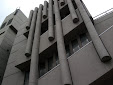
The photos shown in this blog are of the Roger Stevens Lecture Theatre (colloquially known simply as 'Roger Stevens'). People's views on the aesthetics of the building (students and academics alike) are polarised. However, I think many feel that way about Brutalist architecture generally. The organ-pipe clad concrete-formed Roger Stevens is a prime example of Modernist sixties architecture at its best. Recognised as a Grade II listed building in 2010, its existence has since become justified, following the period in the 70s and 80s when people began to lose faith in the Modernist project, and councils started to pull down their public housing projects (see information and photos on the Pruitt-Igoe, or watch Godfrey Reggio and Philip Glass's superb film Koyaanisqatsi to see its demise).
The original design for the Roger Stevens was very different from the final lecture theatre, as can be seen in the architecture's mock-up below:
The final Roger Stevens is woven into the campus via raised walkway access (as above) which seamlessly takes you from the higher ground further up the hill, directly into the building. However, once inside things begin to get complicated. Most people find it hard to negotiate because of multiple staircases and what seems like an unintuitive layout. I have been at the university since 2005 and always have a problem finding the actual lecture theatre I am looking for.
One of the more intriguing and lesser known facts about the Roger Stevens, though, is that a broadcasting studio was built in the basement. I didn't know about it till 2012 when an exhibition was held there: Celine Condorelli's 'Additionals'. I went to the private viewing and include some of the photos I took of the event below:
In the last blog I mentioned how little information there was on CPB, especially by themselves, however I did come across an article by Chamberlin in The University of Leeds Review (May 1969) entitled 'The Evolution and Realization of the University Development Plan' and include a quote from that article here:
Film: The Sound of the Sixties: Chamberlin, Powell and Bon
Links:
Chamberlin, Powell and Bon: Space Age or Quasi-Totalitarianism?
Chamberlin, Powell and Bon: Does the old campus make sense in the present?
Chamberlin, Powell and Bon: The Return of the Repressed
For Part 1 of this blog, please click here: Chamberlin, Powell and Bon in London
Thanks to those of you who met me at the Barbican in my last blog. We are now in West Yorkshire at the University of Leeds, taking a look at the work that Chamberlin, Powell and Bon (CPB) undertook on the campus in the 60s, as Master Planners for the big post-war campus project. The challenge for the university and CPB at this time was manifold and included such problems as creating a holistic and cohesive campus, offering a look and feel that would signify the vision of a new university, and to do this within the scope and limitations set by both the university and the city itself. The two plans they produced at the early stages of the project are not only fascinating to read, but works of art in their own right (see below).
The photos shown in this blog are of the Roger Stevens Lecture Theatre (colloquially known simply as 'Roger Stevens'). People's views on the aesthetics of the building (students and academics alike) are polarised. However, I think many feel that way about Brutalist architecture generally. The organ-pipe clad concrete-formed Roger Stevens is a prime example of Modernist sixties architecture at its best. Recognised as a Grade II listed building in 2010, its existence has since become justified, following the period in the 70s and 80s when people began to lose faith in the Modernist project, and councils started to pull down their public housing projects (see information and photos on the Pruitt-Igoe, or watch Godfrey Reggio and Philip Glass's superb film Koyaanisqatsi to see its demise).
The original design for the Roger Stevens was very different from the final lecture theatre, as can be seen in the architecture's mock-up below:
The final Roger Stevens is woven into the campus via raised walkway access (as above) which seamlessly takes you from the higher ground further up the hill, directly into the building. However, once inside things begin to get complicated. Most people find it hard to negotiate because of multiple staircases and what seems like an unintuitive layout. I have been at the university since 2005 and always have a problem finding the actual lecture theatre I am looking for.
One of the more intriguing and lesser known facts about the Roger Stevens, though, is that a broadcasting studio was built in the basement. I didn't know about it till 2012 when an exhibition was held there: Celine Condorelli's 'Additionals'. I went to the private viewing and include some of the photos I took of the event below:
In the last blog I mentioned how little information there was on CPB, especially by themselves, however I did come across an article by Chamberlin in The University of Leeds Review (May 1969) entitled 'The Evolution and Realization of the University Development Plan' and include a quote from that article here:
A university should have a sense of wholeness which is not fostered by segregated planning. [...] An early task in evolving a Development Plan was to establish valid principles of design calculated to meet the ascertainable need of the University and to invent a vocabulary of design which could be relied on to meet a whole variety of situations and problems.In the conclusion of Elain Harwood's chapter on the University of Leeds in the RIBA commissioned book, Chamberlin, Powell and Bon, she says of their work at Leeds:
That the Leeds plan as originally envisaged by Chamberlin, Powell and Bon was never fully realised became inevitable following the imposition of financial restraints. Building struggled on through the 1970s, although after 1973 funding was cut by 90 per cent. Powell recalled that 'the government eventually discovered that it had briefly over-expanded higher education.' Money ran out, and a new generation moved in who wanted change.You can watch a film I made based on my own response to the sixties precinct area of the university campus, including the area around the Roger Stevens. Here is part of the abstract for the film by way of explanation. The link to the film is below it: "This 3 minute film is an acoustic psychogeographical response to the area called the precinct and features two of the most impressive buildings of this era."
Film: The Sound of the Sixties: Chamberlin, Powell and Bon
Links:
Chamberlin, Powell and Bon: Space Age or Quasi-Totalitarianism?
Chamberlin, Powell and Bon: Does the old campus make sense in the present?
Chamberlin, Powell and Bon: The Return of the Repressed
Thursday, 4 April 2013
Deconstructing the Ziff - Part 2
Inside/Outside, Right/Left or Behind the Lines
This is part 2 of the blog. Please click here for Part 1
You can just see a little PEEP of the passage in Looking-glass House, if you leave the door of our drawing-room wide open: and it's very like our passage as far as you can see, only you know it may be quite different beyond. Oh, Kitty! how nice it would be if we could only get through into Looking-glass House! (Lewis Carroll Through the Looking-Glass)In the above photo of the Marjorie and Arnold Ziff building at the University of Leeds, you can see a reflection of another building in the sheath-like glass fascia. This is the Michael Sadler building next to it, a building from another period and made of Portland Stone on this side. Portland Stone was used a lot in civic buildings for a few hundred years until the 20th century. As a material it makes a statement about public life and civic pride. Not only can we often see it in buildings belonging to royalty, such as Buckingham Palace, but also in our Town Halls. So when we pass this side of the Ziff building we can see the Michael Sadler building doubled, in both its real self on one side of us, and it's reflection on the other side. This reminds us that while the University of Leeds is a contemporary university (we have, and can afford, a brand new postmodern building like 'the Ziff'), it also has historic civic origins which add gravitas to the perception of it as an established university. This is what the university said about the Ziff building in a press release at the point the building work was planned:
The Marjorie and Arnold Ziff building [...]will present a world-class face to the community it serves - the University's past, present and future students, its partners and the region. The building will also represent, more visibly than any other project, the ambitious plan for Leeds to rank among the world's top 50 universities by 2015. (University of Leeds 2006)While the mirror-like quality of glass has the effect of opening up space - the Ziff building fits snugly into what was a relatively small 'vacant plot' - it also reflects the university back onto itself in the same way the Westin Bonaventure does with LA. The Ziff building presents both a "word class face" yet also, in the same moment, reaffirms its past.
Reinhold Martin explains the effects of this mirroring quality which is so prevalent in postmodern architecture. He describes it as forming "feedback loops" which constantly repeats binary structures such as: "inside outside inside outside", "vertical horizontal vertical horizontal" or "right left right left". (2010: 106) The effects of this may be more apparent in a photograph of the other side of the Ziff building (see above). This side of the building is a wall of curved glass and steel. The mesh-like steel decoration, while part of the building, is also reflected in the building itself. So the steel appears twice, creating the lines of the complex matrix you can see here.
Here we not only see the surrounding area reflected in the face of the building, but also the steel embellishment reflected in the building too; the building also reflects itself. Martin says that these mirrored architectural styles are "less oppositional or complementary than they are redundant, a doubling back of the surface onto itself". (ibid.) He goes on to say that the mirror is a function belonging to postmodernism as it appears as late capitalism, agreeing with both David Harvey and Fredric Jameson's dialectical critiques of how capital operates in urban space. Martin says this occurs at the "point at which what is culture and what is capital cannot be distinguished in any useful way." (ibid.)
This is apparent in the reaffirmation of the university's current strapline in their press release above about the Ziff building: "The building will also represent, more visibly than any other project, the ambitious plan for Leeds to rank among the world's top 50 universities by 2015". As Martin explains, architecture "appears as a cipher in which is encoded a virtual universe of production and consumption, as well as a material unit, a piece of that universe that helps to keep it going." (Martin 2010: xi)
This becomes an interesting point when it comes to postmodern artworks such as Anish Kapoor's mirrored public sculptures, for example his 2010 artwork Turning the World Upside Down and, especially, Cloud Gate (2006) (above) which reflects Chicago back onto itself. The $23 million it cost to fund Cloud Gate, came from donations from individuals and corporations.
Bibliography:
Jameson, Fredriç. 2009. Postmodernism or The Cultural Logic of Late Capitalism (London and New York: Verso).
Martin, Reinhold. 2010. Utopia's Ghost: Architecture and Postmodernism, Again (London: Profile Books).
University of Leeds. 'Marjorie and Arnold Ziff Building', The Reporter (27 November 2006),
Subscribe to:
Posts (Atom)