This map is based on the Naked University Map which I included in my MA dissertation. I have taken the original image, based on Guy Debord's Naked City Map, and turned it into another Situationist-style map based on 'Guide Psychogeographique De Paris'. The ambiances of the quarters at the University of Leeds have been translated into song titles which are listed in the key.
Showing posts with label "guy debord". Show all posts
Showing posts with label "guy debord". Show all posts
Sunday, 14 February 2010
Guide Psychogeographique De University of Leeds
This map is based on the Naked University Map which I included in my MA dissertation. I have taken the original image, based on Guy Debord's Naked City Map, and turned it into another Situationist-style map based on 'Guide Psychogeographique De Paris'. The ambiances of the quarters at the University of Leeds have been translated into song titles which are listed in the key.


Monday, 24 August 2009
Walking: The Act of Moving About
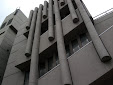
The walked paths taken by human beings through space is controlled by many urban features. There are the more obvious solid objects like walls and fences that prevent people from taking certain routes through space, but not all of these barriers are solid: they might simply exist in the form of a notice stating 'No Entry'. But, often space is controlled in a much more subtle way. For example, the idea of 'walkways' which were popularised by architects in the 1960s, especially in regards to university space. Walkways were meant to join areas of the campus together and also encourage students to 'bump into each other'. Even though this seems like an community-spirited idea, it has the function of controlling space in such a way that students are discouraged from taking other routes.
Merlin Coverley explains that it is only by challenging assumed routes and investigating the unnoticed and dismissed areas, that one can get any real sense of what exists behind the surface of what appears as the everyday (2006 : 12-13). The students, academics and staff of the university move across the campus surface on established well-worn paths. Individuals tend to follow the same routes, as much for expedience as anything else. It is extremely unlikely that an undergraduate student attending a three year course would cover the paths that appear on the university pedestrian route map in the time they are at the university, let alone any routes that do not appear. As individuals in a busy postmodern world, we need to have an actual reason to go somewhere in order to see to see a new space; we are unlikely to wander, just for the sake of it. There could be many reasons for this, the discussion of which could make for a project in its own right. However, 'cheap' cars and a culture that does not encourage walking, do not help. Previous generations in Britain (and other cultures) walked most of the time. For example, in the 1960s it was considered perfectly acceptable to allow your children to walk to school, even when quite young. Multiple transport options allow people to move from place to place easily, but this also discourages the process of seeing the movement between places as an event in itself, an exploration of space. Walking enables the minutiae of the environment to be examined. Guy Debord explains how the city discourages detours because of its make-up: “cities have a psychogeographical relief, with constant currents, fixed points and vortexes which strongly discourage entry into or exit from certain zones.” (1996: 22).
A large part of the practise behind this project has involved providing other paths around the University of Leeds campus in an effort to: challenge the established route; experience the campus in a different way; and as an attempt to probe the very fabric of the university in order to encourage it to reveal its history. This has taken the form of a number of dérives (see other blogs). Debord states: “The city is the locus of history because it is conscious of the past and also concentrates the social power that makes the historical undertaking possible.” (2005: 176). This can also be applied to the university. The past of the university exists in the very fabric of the campus, and it tells a story of power; not just in the form of administrative decisions such as those highlighted when discussing the Compulsory Purchase Orders, but also the less obvious ones about how an individual moves around the campus. This history does not only exist in historical documents; the actual campus itself can also be read in an attempt to investigate the past, and even the future.
Bibliography:
Coverley, Merlin. 2006. Psychogeography (Harpenden: Pocket Essentials).
Debord, Guy. 1996. 'Theory of the Dérive', Theory of the Dérive and Other Situationist Writings on the City, ed. by Libero Andreotti and Xavier Costa (Barcelona: Museu d'Art Contemporani de Barcelona). pp. 22-27.
Debord, Guy. 2005. The Society of the Spectacle (Detroit: Black and Red).
Merlin Coverley explains that it is only by challenging assumed routes and investigating the unnoticed and dismissed areas, that one can get any real sense of what exists behind the surface of what appears as the everyday (2006 : 12-13). The students, academics and staff of the university move across the campus surface on established well-worn paths. Individuals tend to follow the same routes, as much for expedience as anything else. It is extremely unlikely that an undergraduate student attending a three year course would cover the paths that appear on the university pedestrian route map in the time they are at the university, let alone any routes that do not appear. As individuals in a busy postmodern world, we need to have an actual reason to go somewhere in order to see to see a new space; we are unlikely to wander, just for the sake of it. There could be many reasons for this, the discussion of which could make for a project in its own right. However, 'cheap' cars and a culture that does not encourage walking, do not help. Previous generations in Britain (and other cultures) walked most of the time. For example, in the 1960s it was considered perfectly acceptable to allow your children to walk to school, even when quite young. Multiple transport options allow people to move from place to place easily, but this also discourages the process of seeing the movement between places as an event in itself, an exploration of space. Walking enables the minutiae of the environment to be examined. Guy Debord explains how the city discourages detours because of its make-up: “cities have a psychogeographical relief, with constant currents, fixed points and vortexes which strongly discourage entry into or exit from certain zones.” (1996: 22).
A large part of the practise behind this project has involved providing other paths around the University of Leeds campus in an effort to: challenge the established route; experience the campus in a different way; and as an attempt to probe the very fabric of the university in order to encourage it to reveal its history. This has taken the form of a number of dérives (see other blogs). Debord states: “The city is the locus of history because it is conscious of the past and also concentrates the social power that makes the historical undertaking possible.” (2005: 176). This can also be applied to the university. The past of the university exists in the very fabric of the campus, and it tells a story of power; not just in the form of administrative decisions such as those highlighted when discussing the Compulsory Purchase Orders, but also the less obvious ones about how an individual moves around the campus. This history does not only exist in historical documents; the actual campus itself can also be read in an attempt to investigate the past, and even the future.
Bibliography:
Coverley, Merlin. 2006. Psychogeography (Harpenden: Pocket Essentials).
Debord, Guy. 1996. 'Theory of the Dérive', Theory of the Dérive and Other Situationist Writings on the City, ed. by Libero Andreotti and Xavier Costa (Barcelona: Museu d'Art Contemporani de Barcelona). pp. 22-27.
Debord, Guy. 2005. The Society of the Spectacle (Detroit: Black and Red).
Monday, 3 August 2009
Miniature Boulder Dérive

Image: Phill Harding
Saturday August 1st 2009. We set off from the Parkinson Steps at the University of Leeds at approximately midday. Five members of the group were present. The method used for the randomness quotient of the dérive was as follows:
Take a downloaded piece of Situationist text ('The Theory of the Dérive' by Guy Debord). Using a piece of tracing paper, draw a dot over the first word on each line that begins with a 'p' (for 'psychogeography'). Make a separate note of all these words. Lay the tracing paper over a map of the University of Leeds campus. Draw a line, moving from right to left which connects those dots that lay on top of the map. Ignore the dots that are outside of the map. The end result is a zigzag line on the tracing paper that is superimposed over the map. The line becomes the route (as much as possible that it can be followed), the dots become the stopping places. Each point of stopping would then have the relevant word attached to it. Also, the photographs attached to the map, would be a picture looking towards the next point that would be visited.
As before, we had a GPS tracking device, and two cameras, one attached to the stopping points on the map, as can be seen below.
http://tinyurl.com/augustderive
Map: Tim Waters
We began our dérive from the North edge of the university and worked towards the South, in a zigzag fashion. Within a few minutes of beginning, a 'found object' was stumbled upon, hence the name of the dérive (see image above).
This campus dérive seemed to take us to a number of maintenance-related sites on the campus, including a section of the university that had asbestos located in a room behind the geography/textiles blocks area. There was a warning on the door, but the door had been left open, and the area was not protected.
A number of redundant signs were found during the walk. Smallish, unobtrusive, plastic signs in varying primary colours, with arrows on. These were on a number of buildings in the area around the Union building. No text appeared alongside the arrows.
We also found an area that was being treated for Japanese Knotwood. It was fenced off and had been treated due to its rhizome-like root format:
http://en.wikipedia.org/wiki/Japanese_Knotweed
Again we ended up in St. George's Field, but our route this time was different and we discovered a whole new set of phenomenonon in the cemetery. Including small memorial spots (maybe actual graves): one for a 6 month old child, going back to 1946.
We discovered a blue plaque dedicated to Sir Clifford Allbutt, who apparently invented the clinical thermometer, which replaced the previous one-foot long one that the poor ill patients had to not only negotiate into their mouths but also hold in place while it took 20 minutes for the result to appear!
We also found a very attractive building called 'The Priory', which had no connection to drug rehabilitation. Upon enquiry we found out it was a halls of residence. It is apparently a private organisation that provides student accommodation. This property On the dge of the Leeds campus charges £115/week and describes itself as “Truly Unique Student Accommodation”:
http://www.crm-students.com/student-accommodation/uk/leeds/
The weather was poor. We were rained on more than once. Our dérive ended at approximately 4.00pm, but in that time we had at least 2 generous breaks. At some point during the dérive we realised we had been using the words attributed to each point in reverse order. We interpreted this as part of the chance element of the walk.
We did not complete the whole of the original path assigned to the map by the above-mentioned method. However, it will be completed shortly, and will, of course, appear as a separate dérive because: a dérive is "considered as the time between two periods of sleep" (Guy Debord).
N.B. This is the blog of one member of the group, and therefore is subjective.
Subscribe to:
Posts (Atom)