For the ‘Ruhleben - Lofthouse Park Civilian Internment Project’
Please click here for Part 1 of the blog.
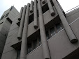
The above image is of the new estate, which according to the developers is actually called Lofthouse Park, which is interesting since that was also the name of the internment camp, so maybe not thought through too well (the roads in the new estate mostly begin with ‘Springfield’ so this may have been a better name). However, from our calculations it is possible that the new estate does overlap the old camp to a very small degree, although it is the older estate to the south that seems to cover the ground that was the camp, along with the Peter Duffy field mentioned in the last blog. The older estate looks, predominantly, interwar and has a variety of different housing, quite a lot of which looks like ex-public housing.
The above images are on either side of the road that separates the two estates. There were a couple of telegraph poles on this road, but none on the new estate, since they are not needed any more. Opposite one of the telegraph poles (the one further on from the disturbing UKIP one shown above) there was the junction box, which you can just see in the other image. Tim Waters was interested in this infrastructure in relation to the old camp. I tried to find some information about the telegraph system that may have existed at that time, and interestingly came across this document, from The Rothwell Courier and Times, that discusses the escape of prisoners from the camp on July 3rd 1915: ‘How Two Men Got Away’.
I’m afraid I didn’t take enough photos of the old estate, as we didn’t know during the walk itself that this was the area that would have been the camp itself. However, I did get a picture of this lovely old shed. It’s pretty dilapidated (and made of corrugated metal, like the Nissan huts would have been) and we wondered if it could possible date back to the time of the camp.
The image above, while not on the camp site, is not too far away in the area called Lofthouse Gate and is a memorial for the Lofthouse Colliery There was a mining disaster there in 1973, although the memorial does not mention that. There is a memorial that does honour the dead in Wrenthorpe, which is not far from Lofthouse. The colliery would have also been there in WWI since the dates on the stone say 1871-1981. The border for the administrative districts of Leeds and Wakefield are in this area somewhere between Lofthouse Park and Lofthouse Gate.
Above I have included a super map by Tim Waters, which overlays the old camp on the current space. This map shows the area of the camp as an amusement park, which is what is was before it became the internment camp. You can just see there is a slight overlap at the north of what was the camp on what is now the new estate (see Springfield Rd and Springfield Ave). The area on the south-west of the new estate is the old estate (see Park Ave – maybe referring to the previous amusement park) and the field to the east of that is the scrubland owned by Peter Duffy.
Showing posts with label Lofthouse Park Civilian Internment Project. Show all posts
Thursday, 3 December 2015
Friday, 27 November 2015
A Psychogeography of Lofthouse – Part 1
For the ‘Ruhleben - Lofthouse Park Civilian Internment Project’
On November 25th 2015 Tim Waters and I carried out a drift around what had been, in the First World War, a prisoner of war internment camp in Lofthouse, Wakefield, West Yorkshire. The particular area that was the camp, is adjacent to a modern housing estate located opposite the golf course.
The image below is taken from Wakefield Libraries Collection and I found it on 'The Neglected Books Page' which discusses a book called Time Stood Still: My Internment in England 1914-1918, by Paul Cohen-Portheim. The book is about a German civilian who was interned at Lofthouse. The overview of the book (linked above) is worth reading as it gives you an insight into life there from one person’s perspective:
The objective of our walk was psychogeographical to the extent that a) we were looking for material archaeology in the terrain that may lead to clues of the area’s past and b) we wanted to get as sense of the aesthetics of the space as it is today.
A good example of material archaeology are drain covers, inspection covers, manhole covers and infrastructure grills of various kinds. They can often tell you about the industrial (and social) history of an area. Sometimes you are able to date the object itself, which then indicates infrastructure work during a particular period in the area’s history. The above cover is for Yorkshire Water Authority and is on the north of the area that would have been the original camp. Yorkshire Water no longer use the ‘authority’ part of the name, so this dates it prior to the privatisation of water authorities in the UK under the Water Act of 1989. The company name is Brickhouse Dudley, and as this article in Black Country Bugle explains, the company used this name prior to 1967. So we can be sure that this part of the water system was either installed, extended or updated at some point prior to that time.
The above image is on the large set of flats on the entrance to the estate. Tim and I thought it very odd that windows on a new building had been filled in. It is reminiscent of the window tax of the 18C and 19C.
While we did walk around the new estate, we felt the periphery of it would lead us to more 'concrete' clues. This blob of concrete, with a smudge of yellow road-marking paint on it, was quite near the water and electricity infrastructure hub, which was surrounded by bollards in a most striking way, placed to prevent any temptation of the will to park!
While we were at this above spot a woman pulled out of the estate in her BMW, which indicated to me that this was probably a ‘middle-class’ housing estate, although Tim thought that the empty jar of olives was a better indication. I had to agree.
This fenced-off ‘scrubland’ to the south of the new estate probably partly covers the area that was the original camp. It would have been interesting in term of signs on the ground if we could have accessed it. Peter Duffy dominated this side of the estate. When we came across this sign we were unsure what the company did. But it later became apparent, when co-incidentally our different route back to the station took us past their HQ. They are civil engineers.
The picture below is both a random image of a psychogeographer in action, but also it is the gateway from the new estate onto a public footpath that takes you into a nearby field.
We went to the edge of this agricultural field and tried to look on the ground for any old bricks or stones that led to any clues.
I later read that the site used to be Roper’s Brickworks. From what I can tell Roper’s seems to be related to this quarry which dominated the Lofthouse Gate area at one time: Lofthouse Gate Brickworks. In the book Welcome to my World the author, Charlie Walker, says:
Part 2 of the blog is available here.
On November 25th 2015 Tim Waters and I carried out a drift around what had been, in the First World War, a prisoner of war internment camp in Lofthouse, Wakefield, West Yorkshire. The particular area that was the camp, is adjacent to a modern housing estate located opposite the golf course.
The image below is taken from Wakefield Libraries Collection and I found it on 'The Neglected Books Page' which discusses a book called Time Stood Still: My Internment in England 1914-1918, by Paul Cohen-Portheim. The book is about a German civilian who was interned at Lofthouse. The overview of the book (linked above) is worth reading as it gives you an insight into life there from one person’s perspective:
“The past was dead, the future, if there should be a future, was a blank, there was nothing left but the present, and my present was the life of a prisoner.” (Paul Cohen-Portheim).
The objective of our walk was psychogeographical to the extent that a) we were looking for material archaeology in the terrain that may lead to clues of the area’s past and b) we wanted to get as sense of the aesthetics of the space as it is today.
A good example of material archaeology are drain covers, inspection covers, manhole covers and infrastructure grills of various kinds. They can often tell you about the industrial (and social) history of an area. Sometimes you are able to date the object itself, which then indicates infrastructure work during a particular period in the area’s history. The above cover is for Yorkshire Water Authority and is on the north of the area that would have been the original camp. Yorkshire Water no longer use the ‘authority’ part of the name, so this dates it prior to the privatisation of water authorities in the UK under the Water Act of 1989. The company name is Brickhouse Dudley, and as this article in Black Country Bugle explains, the company used this name prior to 1967. So we can be sure that this part of the water system was either installed, extended or updated at some point prior to that time.
The above image is on the large set of flats on the entrance to the estate. Tim and I thought it very odd that windows on a new building had been filled in. It is reminiscent of the window tax of the 18C and 19C.
While we did walk around the new estate, we felt the periphery of it would lead us to more 'concrete' clues. This blob of concrete, with a smudge of yellow road-marking paint on it, was quite near the water and electricity infrastructure hub, which was surrounded by bollards in a most striking way, placed to prevent any temptation of the will to park!
While we were at this above spot a woman pulled out of the estate in her BMW, which indicated to me that this was probably a ‘middle-class’ housing estate, although Tim thought that the empty jar of olives was a better indication. I had to agree.
This fenced-off ‘scrubland’ to the south of the new estate probably partly covers the area that was the original camp. It would have been interesting in term of signs on the ground if we could have accessed it. Peter Duffy dominated this side of the estate. When we came across this sign we were unsure what the company did. But it later became apparent, when co-incidentally our different route back to the station took us past their HQ. They are civil engineers.
The picture below is both a random image of a psychogeographer in action, but also it is the gateway from the new estate onto a public footpath that takes you into a nearby field.
We went to the edge of this agricultural field and tried to look on the ground for any old bricks or stones that led to any clues.
I later read that the site used to be Roper’s Brickworks. From what I can tell Roper’s seems to be related to this quarry which dominated the Lofthouse Gate area at one time: Lofthouse Gate Brickworks. In the book Welcome to my World the author, Charlie Walker, says:
“I had obtained a job at a local brick yard: Roper's Brickworks at Lofthouse Gate near Wakefield. It was owned by Aberford Quarries and managed by a great bloke called Cliff Farrar. Cliff lived in a big house nearby and had become the manager after marrying the previous owner’s daughter. Yes, Cliff’s wife was old man Roper’s daughter.”
Part 2 of the blog is available here.
Subscribe to:
Posts (Atom)